An Intimate Look on the Processes Involved in 3D Aerial Mapping
Read the latest Hassan Sadiq blog. Hassan Sadiq is a British tech entrepreneur that has been involved in 3D mapping and virtual reality. He has established a career of leading and starting up successful companies. A savvy businessman, he has also helped turn around a number of failing companies. He is the name behind successful names in the tech industry such as New Planet Solutions, WRLD3D, and Innovation Group Ltd, among others.
The potential of 3D mapping and modelling are quite clear for those involved in the gas and oil industry. These organisations are able to successfully look at accurate, detailed, and clear presentations of a facility or a piece of land through the technology. It is now easier for them to come up with effective plans while also feeling more confident that the assumptions that they will make are going to be accurate.
These days, one of the most popular means to capture data that are required in the creation of 3D models is through the use of UAVs. Also known as unmanned aerial vehicles, they are effective at successfully mapping terrains that otherwise would have been impossible to plot and map. If you are employing 3D aerial mapping for the first time, below are some tips that you will find useful.
While it is important that you use the latest technology as well as employ proper techniques in order to get good results out of your 3D mapping process, remember to consider the condition of the area that you are surveying and mapping first. The latest gadget will not be able to do anything for settings that have suboptimal conditions. Always consider the time of the day and the weather before you will decide to schedule an of your drone flights to make the most out of the opportunity.
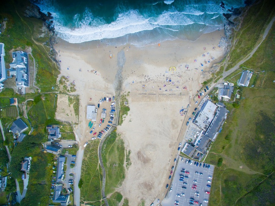
You will need to capture nadir images when doing the mapping process. These are images that are looking down on a building or a terrain directly from above. These are going to be the baseline for the 3D models that you will be making. It should be easy enough to design and program a UAV flight to capture them.
Your next step is to capture oblique images. These are images that are being captured from the side. This makes it possible for you to pick up on certain details that you probably would have missed by capturing nadir images alone. Flying the drone in circles around the site using 45-degree angle tilted camera usually works.
Once all the images have been captured, the next step is to process them so you can start creating the model. There are processing software that you can use in order to get this done. They would be responsible for taking the images and then stitching them together into one single representation in 3D. If you choose the right software, you can even have a model that is ready to use in just a matter of hours.
Aerial mapping in 3D is something that anybody can do as long as they have enough time and the necessary knowledge to get the task done. Learn more about useful 3D aerial mapping techniques by reading about Hassan Sadiq Himex online here. You can learn more about Hassan Sadiq Himex here and visit Hassan Sadiq Himex Quora page here.
